The town of Ocean and state of Maryland are preparing for the worst as a potent coastal storm is set to intensify off the Carolina coast on Oct. 10 and track northward, passing off the coast of Maryland this weekend.
Here’s more on preparations, but first a link to the detailed forecast for the Lower Shore through Monday.
What’s in weekend forecast for Salisbury, Ocean City?
WEEKEND FORECAST FOR SHORE: Coastal storm to hammer Maryland Lower Shore with flooding, high winds and more
Ocean City warns of possible king tides, dangerous surf conditions
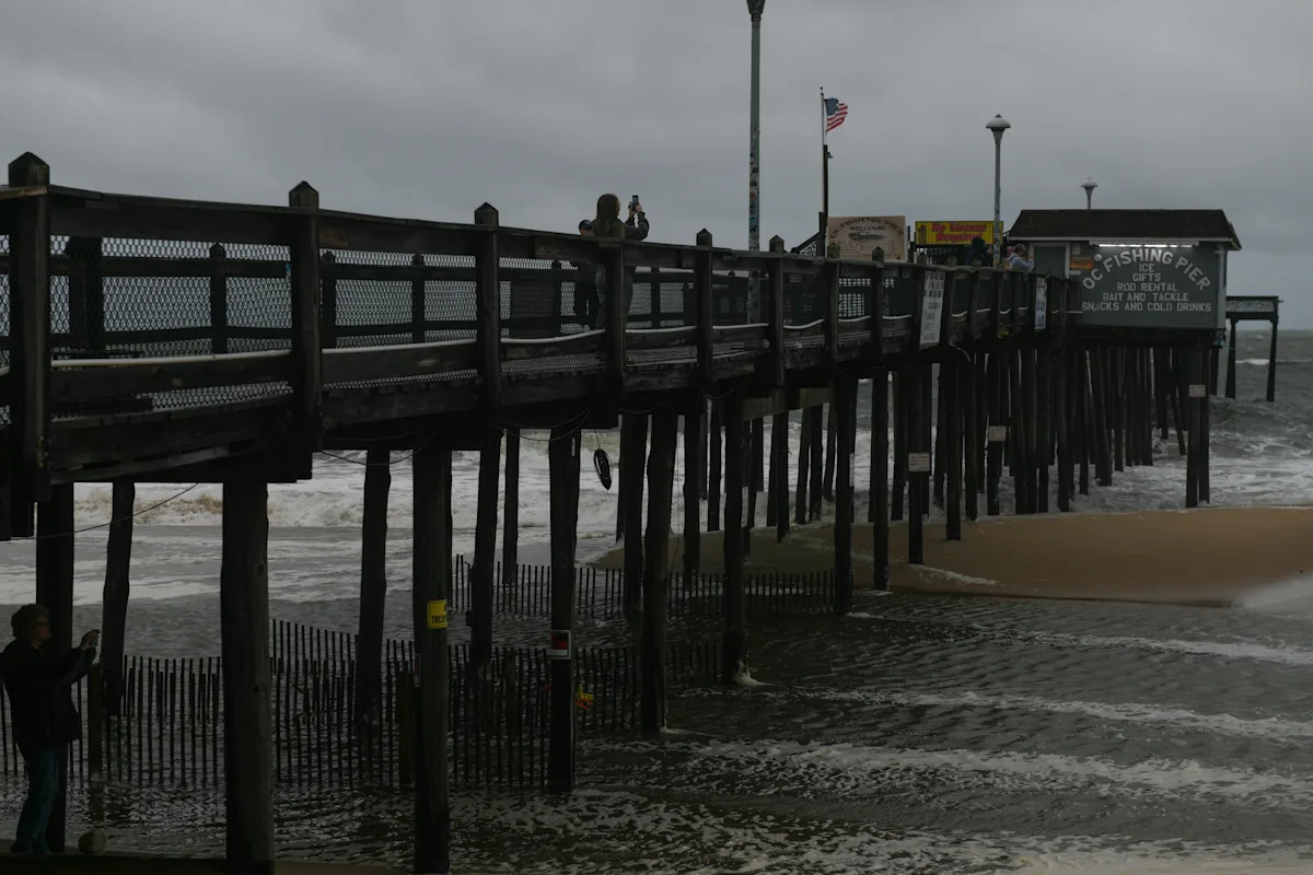
The fishing pier Tuesday, Aug. 19, 2025, in Ocean City, Maryland.
The town of Ocean City also warned residents to be on high alert, and warned in particular of the following hazards:
-
High winds: Strong winds are expected to develop after midnight Saturday and continue into Sunday evening, with gusts of 50–55+ mph possible along the coast. Isolated power outages may occur.
-
King tides: Elevated tides throughout the weekend will exacerbate coastal flooding impacts.
-
Dangerous surf conditions: Hazardous surf and rip currents are expected at all beaches through the weekend.
To receive the latest updates, residents and visitors are encouraged to sign up for Ocean City’s e-news alerts at oceancitymd.gov/enews. Information and updates will also be shared through the following official channels:
Cruisin’ announces date changes ahead of coastal flooding
Endless Summer Cruisin’ event organizers have made a big change to this weekend’s schedule for the Ocean City event.
Ahead of Sunday’s storm, which is anticipated to bring coastal flooding and high winds, organizers have now moved all Sunday, Oct. 12, events to Saturday, Oct. 11. The news was shared in an Oct. 9 Facebook post.
“For the safety of our participants and spectators, we have made the decision to move all Sunday events to Saturday. Stay tuned for an updated, exciting, jam-packed Saturday schedule. Thank you for understanding,” the post read.
ALL TO KNOW ON CRUISIN’: Ocean City’s Endless Summer Cruisin makes big schedule change with severe weather expected
Gov. Moore urges Marylanders to stay safe in storm
Gov. Wes Moore is also urging Marylanders to stay vigilant as the Maryland Department of Emergency Management is closely monitoring the storm. The state is preparing for a range of coastal and inland impacts, with the timing and severity dependent on the final storm track.
“We must take every available precaution to protect each other and keep our communities safe,” said Gov. Moore. “Our administration is continuing to watch this storm carefully as it develops, and we will communicate clearly with the public as the situation evolves. I also encourage all Marylanders to ensure their loved ones and neighbors are properly monitoring the potential for high winds, rain, and flooding. Take care of yourself. Take care of your people.”
The Maryland Department of Emergency Managementis coordinating closely with local jurisdictions and the National Weather Service, and advises those within the storm’s track to:
-
Avoid unnecessary travel during peak storm periods, particularly along vulnerable coastal and low-lying routes especially along the eastern seaboard.
-
Secure outdoor furniture, boats and other objects that may become projectiles in high wind.
-
Be prepared for temporary power outages — keep flashlights, batteries, and basic supplies handy.
-
Monitor local river gauges, and always avoid driving through flooded roadways.
-
Stay alert by following updates from your local emergency management office, NOAA/NWS forecasts, local media, and official briefings for updated information and possible watches or warnings.
Key impacts and risk expected in Maryland
-
Winds: Gusts up to 55 mph are possible along coastal zones and the Chesapeake Bay shoreline, with potential to extend into central Maryland.
-
Coastal and Tidal Flooding and Erosion: Moderate to major coastal flooding is expected on Sunday.
-
Wave heights through Sunday night may exceed 12-14 feet, with potentially significant beach erosion and wash-ups from waves.
-
Rain and dlooding: Several inches of rain late Saturday night into Sunday — possibly extending into Monday — may lead to small stream, creek, and river flooding, particularly in low-lying and poorly drained areas.
-
Power and infrastructure: The combination of wind and saturated soils raises the possibility of isolated power outages, tree damage, and downed lines.
-
Public safety and travel: Hazardous marine conditions, high surf, coastal flooding, and gusty winds will make some travel difficult — especially along coastal roads and bridges.
Residents are also encouraged to follow the Maryland Department of Emergency Management’s social media feeds:
This article originally appeared on Salisbury Daily Times: Maryland, Ocean City warn residents of dangers of potent storm coming
Disclaimer: This news has been automatically collected from the source link above. Our website does not create, edit, or publish the content. All information, statements, and opinions expressed belong solely to the original publisher. We are not responsible or liable for the accuracy, reliability, or completeness of any news, nor for any statements, views, or claims made in the content. All rights remain with the respective source.
